.svg)
Cadets Create Apps for Hiking Trails
LEXINGTON, Va. May 13, 2024 — The beauty and grandeur of the Blue Ridge Mountains, the Shenandoah Valley and the Appalachian Trail are unmatched, and a beacon to all who enjoy outdoor adventure. Campers, backpackers, and day hikers come from all over the country to experience Virginia’s natural majesty.
But what about those with mobility impairments? Should rocks, slopes, and steep elevations prevent them from enjoying the trails? Not if 12 Virginia Military Institute electrical and computer engineering (ECE) majors have anything to do with it. For the past academic year, they have worked on their senior capstone projects with three external partners to develop a better way to document and assess hiking trails and share information about their navigability. 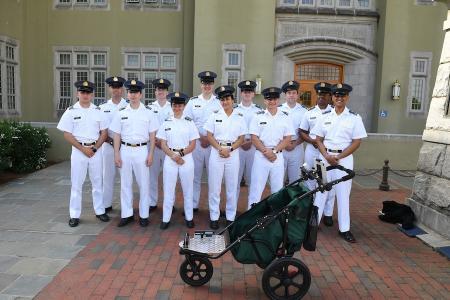
According to Lt. Col. David Feinauer, associate professor of ECE, Quality of Life Plus (QL+) is a nonprofit organization that challenges STEM college students to create innovative technology to improve the quality of life for injured veterans, first responders, and others who have served the nation.
“The engineering capstone experience is an important milestone. It is an academic crucible event where students are challenged and emerge stronger, more confident, and more prepared for their future careers. Quality of Life Plus is a great organization to work with for these projects,” he said.
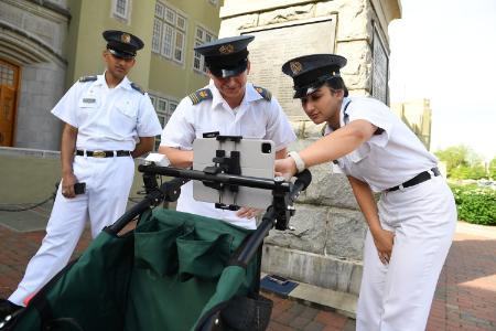
QL+ brought two other organizations to VMI as challengers to the ECE cadets: Move United (MU), a nonprofit which promotes adaptive sports to youths and adults who have physical impairments; and Beneficial Designs (BD), a rehabilitation research and design firm which focuses on creating solutions for people with mobility impairments. The challengers asked the ECE majors to improve the High-Efficiency Trail Assessment Process (HETAP) created by BD to map hiking trails, and to make information about trail navigability publicly accessible.
“The mapping of trails is the most important feature for those with mobility impairments, as it provides detailed information about each trail, and can make trail hiking a more accessible form of recreation and exercise. While the current HETAP system works, the challengers wished for improvements to the software compatibility with mobile devices, wireless connections between the sensors and computer, and a way to directly submit the data gathered to ArcGIS, a geographic information system. These changes would make the system easier to use, and increase the data collection without affecting accuracy,” explained Feinauer.
 The cadets were divided into two teams, each working on a different aspect of the problem. Team A, led by Robert Moran ’24 from Lynchburg, Virginia, focused on high-level measurements including trail slope, cross-slope, trail width and distance. They created a mobile device app that is user-friendly, provides GPS tracking, scalable (meaning it can handle an ever increasing number of users), and is ABA compliant in its detections.
“Users can mount their mobile device with augmented reality capabilities to a wheeled cart, stroller, or wheelchair, walk a trail and create a real-time map. Pins can be dropped to mark certain points on the trail, and the camera on the mobile device can be used to take measurements of the trail width at key points. All the data collected is then processed and made available so potential trail users can gauge the difficulty of traversing the trail,” said Moran.
The team admitted there are some limitations to the app including the fact that it currently only works on Apple devices. The team recommended that cadets next year write script for Android device compatibility, and to work to make the app available on an app store.
Team Z, led by John Lightfoot IV ’24 from Chesapeake, Virginia, focused on providing real-time updates on trail conditions, surface types, and obstacles, to enhance the outdoor experience for all users.
“The goal was to create a mobile app that enables users to easily document their experience on hiking trails, while capturing the necessary data points to be used later for analysis, then communicated to others. Users can report changes in surface type changes and level of firmness through a simple dropdown menu and mark obstacles by dropping location pins. Additionally, users can supplement their reports with images and detailed descriptions. The app has accurate real-time user location tracking,” stated Lightfoot.
Kristie Yelinek, program manager for QL+, has enjoyed working with the cadets.
“Many of the students put in an incredible number of hours into the project, which I think speaks to their dedication, commitment, and work ethic. All of that shows in the quality of the final products. We look forward to working with them on future projects that will benefit veterans and others who have served our country who have adaptive technology needs.”
Jacob Tyree, training coordinator for MU, is also pleased with the cadets’ work.
“They did an excellent job. I grew up in Roanoke with the Appalachian Trail being my backyard to explore and enjoy. I look forward to these apps being used to collect trail data and allow people with disabilities like me, the ability to better plan future outdoor adventures,” he said.
Marianne Hause
Photos by Kelly Nye
Communications & Marketing
VIRGINIA MILITARY INSTITUTE